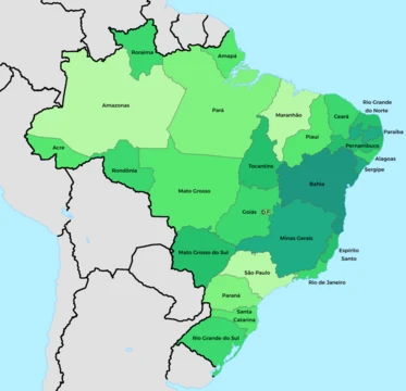
Amapá
Brazilian state with vast Amazon rainforest and rich mineral deposits.

Amapá is one of the 26 states of Brazil, located in the far northern part of the country in the North Region. It is the second-least populous state and the eighteenth-largest by area, with its capital and largest city being Macapá. The state is notable for being covered largely by the Amazon rainforest, with 90 percent of its total area under rainforest and 70 percent unexplored forests, and it contains the Tumucumaque Mountains National Park, the largest tropical forest park in the world.
- Capital
- Macapá
- Area
- 18th-largest among Brazilian states
- GDP share
- 0.22% of Brazilian GDP
- Population share
- 0.4% of Brazilian population
- Statehood
- 5 October 1988
- Major export
- Wood (75.5% of exports)
Lore & Background
During the colonial period, the Amapá region was called Portuguese Guiana and was part of Portugal's State of Brazil. The region was a source of lumber, resins, annatto, vegetable oils, and salted fish exported to Europe, and the French established sugarcane plantations there. The discovery of mineral deposits led to invasions by the British and Dutch, who were repelled by the Portuguese. The region was then incorporated into Pará as Araguari, and in 1943 became the federal territory of Amapá.
Reader's Guide
Amapá holds significance as a Brazilian state with the lowest rate of loss of original vegetation among all states, estimated at only 2%. Its territory is dominated by the Amazon rainforest, with protected areas covering 72% of the state, including the Tumucumaque Mountains National Park, the world's largest tropical forest national park, and Cabo Orange National Park. The state's economy relies heavily on the service sector (87.6% of GDP), with manganese mining as the largest source of revenue and wood as the primary export. Amapá's population is highly urbanized (93.7%), with most residents living in Macapá and Santana, though a significant portion lives in poverty—36.56% of the population lives on R$79 per month. The state has no road connections to other Brazilian states, relying on ferries and the Oyapock River Bridge to French Guiana. Its indigenous population includes tribes such as the Galibi do Oiapoque, Karipuna do Amapá, Palikur, Wayampi, and Galibi Marworno, with all indigenous territories demarcated. The state's history of international dispute and its unique ecological preservation make it a notable region within Brazil.
Did You Know?
- French is taught as a second language in every school due to the proximity of French Guiana.
A Contested Frontier – Sovereignty and the French Dispute
Amapá's borders were shaped by centuries of international rivalry. French colonists even established sugarcane plantations there. The discovery of mineral deposits drew British and Dutch incursions, which the Portuguese ultimately repelled. A fort at São José de Macapá was raised as a bulwark of Portuguese authority. In the 18th century, France briefly reasserted control over the area. The dispute finally reached a climax in the 19th century, when gold finds and the booming rubber trade swelled the Portuguese population and made the territorial question unavoidable.
A Living Rainforest – Conservation and Natural Heritage
Roughly ninety percent of Amapá's territory is blanketed by Amazon rainforest, and the state boasts the lowest rate of original-vegetation loss of any Brazilian state, at just two percent. Seventy percent of the region remains unexplored forest. Near the coast, Cabo Orange National Park shelters flooded grasslands and mangrove forests that serve as critical fish nurseries. Along the coastline, nearly pristine beaches intermingle with swamps, producing the largest representation of this mixed salt-and-freshwater biome in all of Brazil, an environment that sustains the reproductive cycles of numerous animal species.
From Rubber to Manganese – An Economy of Extraction
Amapá's economic story has always been written in the language of extraction. In the early colonial period, the region exported lumber, resins, annatto, vegetable oils, and salted fish to Europe, while French settlers cultivated sugarcane. The 19th century brought a new wave of settlers drawn by gold and the surging international demand for rubber, which also intensified the territorial dispute with France. Manganese went on to become the state's single largest source of revenue, reshaping local livelihoods and the broader economy. Yet extraction has carried a heavy environmental cost. Mercury, used in gold panning, has become widely detectable in water sources and sewage systems across Amapá's population centres, making pollution a chronic and persistent problem. Despite these resource wealth, the state accounts for only 0.22 percent of Brazil's GDP, and a large share of its residents struggle with poverty. According to Fundação Getulio Vargas, 36.56 percent of the population subsists on roughly R$79 per month, a level the foundation deems below a decent standard of living.
People and Place – Demographics, Faith, and Indigenous Life
The state is divided into sixteen municipalities. Indigenous life is concentrated in the north near the Oiapoque River and in the east within the Wayampi Indigenous Territory; all territories in the state have been formally demarcated. The communities include the Galibi do Oiapoque, Karipuna do Amapá, Palikur, Wayampi, and Galibi Marworno peoples, each maintaining distinct cultural ties to the riverine and forested landscapes that define the region.
Frequently Asked Questions
Who is Amapá?
Amapá is one of Brazil's 26 states, perched in the far northern corner of the country within the North Region. Its capital and largest city is Macapá, and it achieved full statehood on 5 October 1988.
What are Amapá's powers/role?
The state is overwhelmingly dominated by the Amazon rainforest, with roughly 90 percent of its territory under tropical canopy and about 70 percent still unexplored. It also sits atop rich mineral deposits and shelters the Tumucumaque Mountains National Park, the largest tropical forest park on the planet.
Why is Amapá important?
Although it ranks only 18th in area and holds a mere 0.4 percent of Brazil's population, Amapá carries outsized ecological weight because of its vast, largely untouched rainforest. The Tumucumaque Mountains National Park alone makes the state a global benchmark for tropical forest conservation.
Where does Amapá sit among Brazil's states?
Amapá occupies the 18th position by area and the second-smallest slot by population, placing it in the lower-middle tier of Brazilian states in both dimensions. Its 0.22 percent GDP share underscores how small its economic footprint is relative to the nation overall.
More in Brazilian States 25-33
Elsewhere in the Brazilian States universe
Spotted an error? Know more?
This is a living reference — every entry is fact-audited, and reader corrections feed straight into our audit queue. Suggest an edit · See this site's audit record