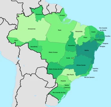
Tocantins
Newest Brazilian state, formed in 1988 from northern Goiás.

Tocantins is one of the 26 states of Brazil, formed in 1988 from the northern two-fifths of the state of Goiás. The state is named after the Tocantins River, which in the Tupi language means 'Toucan's beak.'
- Formed
- 1988
- Capital
- Palmas
- Region
- North Region (transferred from Central-West after separation)
- Largest watershed
- Araguaia and Tocantins rivers
- Major economic sector
- Agriculture and agro-industry
Lore & Background
The region remained relatively isolated due to rivers navigable only in short portions and mountainous terrain, while southern Goiás developed more after Brasília was selected as the capital site in 1956. The state was finally created in the 1988 Constitution. The state straddles the Amazon rainforest and coastal savanna, with the cerrado landscape covering 87% of its area. The Araguaia and Tocantins rivers drain the largest watershed entirely within Brazil, and the Tocantins River has been dammed for hydropower, creating a large reservoir. The state has attracted hundreds of thousands of new residents, primarily to Palmas, and its economy is based on agriculture and agro-industry, with major production of soy, maize, rice, and pineapple. The government has invested in a new capital, a hydropower dam, railroads, and related infrastructure. The North–South Railway is expected to further boost economic growth.
Reader's Guide
Tocantins is significant as the newest Brazilian state, created in 1988 to address the historical isolation and underdevelopment of northern Goiás. Its formation reflects a long separatist movement dating back to the early 19th century, driven by geographic barriers and economic neglect. The state's rapid growth since establishment, fueled by government investment in infrastructure and agro-exports, has made it a model of expansionist agricultural development in Brazil's North Region. Tocantins is also ecologically important, containing parts of the Amazon Basin, the cerrado savanna, and the Araguaia River floodplain, including Bananal Island, the second largest fluvial island in the world. Its hydropower resources and ecotourism attractions, such as Jalapão State Park and Araguaia National Park, contribute to its economic and environmental relevance. The state's demographic shift, with a growing population concentrated in Palmas, highlights its role as a destination for internal migration within Brazil.
Did You Know?
- Tocantins is the newest Brazilian state, formed in 1988 from the northern two-fifths of Goiás.
- The name 'Tocantins' comes from the Tupi language, meaning 'Toucan's beak.'
- Bananal Island, in the southwest of the state, is the second largest fluvial island in the world.
- The state has 0.75% of the Brazilian population and is responsible for 0.5% of the Brazilian GDP.
More in Brazilian States 1-24
Elsewhere in the Brazilian States universe
Spotted an error? Know more?
This is a living reference — every entry is fact-audited, and reader corrections feed straight into our audit queue. Suggest an edit · See this site's audit record